Training on LiDAR for Advanced Spatial Analysis: Data Processing and 3D Modeling

Course Overview
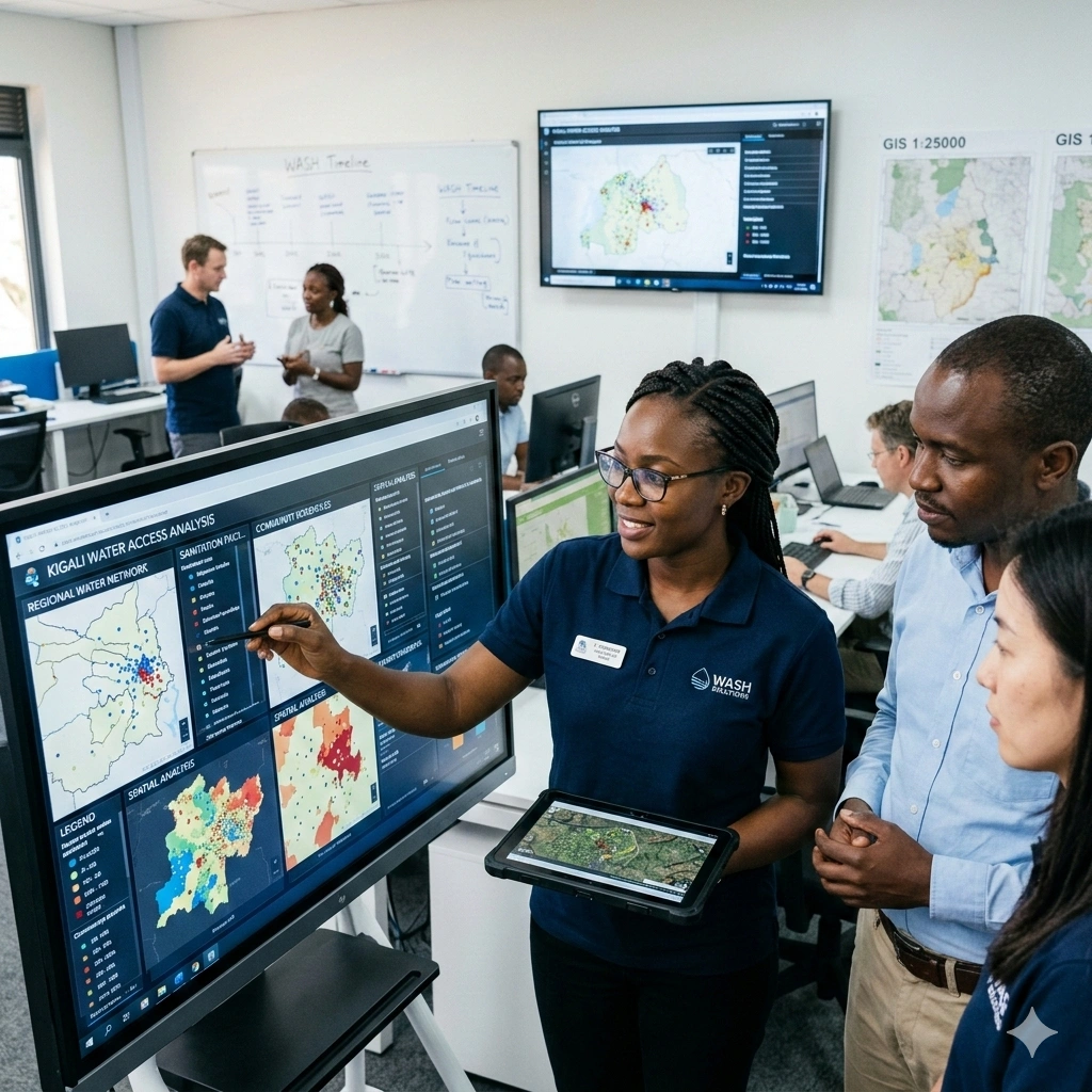
This course provides participants with advanced skills in processing, analyzing, and visualizing LiDAR (Light Detection and Ranging) data for complex spatial applications. Participants will gain hands-on experience handling raw point clouds, performing preprocessing, filtering, and extracting critical features for mapping, modeling, and analysis. The training emphasizes practical workflows from LiDAR data acquisition to 3D modeling, enabling informed decision-making in urban planning, infrastructure development, forestry, disaster management, and environmental monitoring.
The program covers key techniques for 3D spatial modeling, terrain and surface analysis, feature classification, and integration with GIS platforms. Participants will learn to use industry-standard software such as LAStools, PDAL, QGIS, ArcGIS Pro, CloudCompare, Python, and Google Earth Engine to manage large LiDAR datasets efficiently and generate accurate, high-resolution 3D representations of physical environments. Real-world examples illustrate how LiDAR enhances geospatial analysis, improves infrastructure planning, and supports environmental and resource management.
Additionally, participants will explore applications of LiDAR in urban modeling, forestry inventory, hazard mapping, mining, and environmental monitoring. By the end of the 10-day course, attendees will be able to implement LiDAR workflows, create detailed 3D models, integrate LiDAR data with GIS and remote sensing datasets, and communicate geospatial insights effectively for diverse sectoral applications.
Duration
10 Days
Who Should Attend
• GIS and remote sensing professionals
• Surveyors and cartographers
• Forestry and natural resource managers
• Urban and infrastructure planners
• Environmental scientists and climate specialists
• Disaster management practitioners
• Mining and geological mapping experts
• Researchers and academicians in geospatial sciences
Course Impact
Organizational Impact
-
Better decision-making with accurate 3D geospatial data
-
Enhanced capability in urban and infrastructure development planning
-
Improved resource monitoring for forestry, agriculture, and mining
-
Stronger institutional capacity in climate change and disaster risk management
-
Reduced reliance on external consultants for LiDAR-based projects
Individual Impact
-
Mastery of LiDAR data processing and analysis techniques
-
Hands-on experience with industry-standard tools and workflows
-
Ability to design and implement 3D models for real-world applications
-
Advanced technical skills enhancing career opportunities in geospatial sectors
-
Competence in linking LiDAR to policy, planning, and operational needs
Course Objectives
By the end of this course, participants will be able to:
-
Understand LiDAR fundamentals, sensors, and data acquisition techniques
-
Preprocess and clean raw LiDAR point cloud data
-
Classify and extract features for specific applications (buildings, vegetation, terrain)
-
Develop high-quality Digital Elevation Models (DEMs) and 3D city/terrain models
-
Integrate LiDAR with multispectral and hyperspectral datasets
-
Apply LiDAR in forestry, urban planning, climate monitoring, and infrastructure projects
-
Utilize advanced tools and scripting (Python, PDAL) for automated workflows
Course Outline
Module 1: Introduction to LiDAR Technology
-
Principles of LiDAR and remote sensing
-
LiDAR sensors, platforms (airborne, terrestrial, UAV-based)
-
Data characteristics and applications
-
Case study: Urban growth monitoring with airborne LiDAR
Module 2: LiDAR Data Acquisition and Formats
-
Acquisition techniques and system calibration
-
LAS/LAZ formats and metadata
-
Understanding point cloud structure
-
Case study: UAV-based LiDAR for infrastructure mapping
Module 3: Preprocessing of LiDAR Data
-
Noise filtering and outlier removal
-
Point cloud registration and alignment
-
Tools: LAStools, PDAL, CloudCompare
-
Case study: Preparing LiDAR datasets for terrain analysis
Module 4: Point Cloud Classification
-
Ground vs. non-ground classification
-
Identifying vegetation, buildings, and water bodies
-
Automated vs. manual classification methods
-
Case study: Forest canopy height modeling
Module 5: Digital Elevation Models from LiDAR
-
DEM, DSM, and DTM generation
-
Accuracy assessment and validation
-
Tools: ArcGIS Pro, QGIS, Global Mapper
-
Case study: Flood risk modeling using LiDAR-derived DEMs
Module 6: Feature Extraction and Object Detection
-
Building footprint extraction
-
Power lines, roads, and infrastructure mapping
-
Vegetation metrics from LiDAR
-
Case study: 3D building mapping for urban planning
Module 7: 3D Modeling and Visualization
-
Creating 3D city and terrain models
-
Visualization in ArcGIS Pro, Blender, and CloudCompare
-
Integration with BIM (Building Information Modeling)
-
Case study: Smart city development using LiDAR-based 3D models
Module 8: Advanced LiDAR Applications
-
Forestry: biomass estimation, canopy height, forest structure
-
Hydrology: watershed delineation, floodplain mapping
-
Mining: volumetric analysis, terrain deformation monitoring
-
Case study: Forest carbon stock assessment with LiDAR
Module 9: LiDAR Data Integration and Automation
-
Fusion with multispectral, hyperspectral, and SAR data
-
Machine learning applications in LiDAR classification
-
Python scripting for LiDAR processing (PDAL, PyLAS)
-
Case study: Landslide susceptibility mapping with integrated datasets
Module 10: Emerging Trends and Project Development
-
UAV-based LiDAR advancements
-
Cloud processing of LiDAR data (AWS, GEE)
-
Future of 3D geospatial analytics
-
Group project: Designing a LiDAR-based workflow for a chosen sector (urban, forestry, mining, disaster management, or climate)
Prerequisites
Course Administration and Investment
Whether you join us in a physical boardroom or through our virtual campus, we’ve designed every administrative detail for a seamless, professional experience.
Our fees are all inclusive during course hours.
- Covered: High level tuition, comprehensive materials (digital + physical), mid morning and afternoon refreshments, a full executive lunch, and any scheduled study visits or site tours.
- Not covered: Travel, visa fees, medical/travel insurance, personal expenses, and accommodation.
From registration to the classroom, we keep things clear and efficient.
- Registration: Find your preferred schedule, click “Register,” complete the form, and submit. Need help? Talk to us directly.
- Pre Course Assessment: After registering, you’ll receive a diagnostic survey to help facilitators tailor content to your needs.
- Joining Instructions: Once fees are paid, you’ll receive a Delegate Welcome Pack at least 7 days before the start date (venue maps, virtual access links, and pre reading materials).
We provide premium environments optimized for adult learning and networking.
- Physical Venues: Premium 4 star and 5 star executive boardrooms across our global host cities, with high tier catering.
- Virtual Instructor Led Training (VILT): High definition, interactive platforms featuring breakout rooms, digital whiteboards, and live technical support.
- NITA and Regulatory Compliance: Administrative processes align with national training authorities.
You’ll leave with tools that extend the course value far beyond the final day.
- ForElite Learner Kit: A physical or digital course manual, proprietary templates, and a curated toolkit of industry standard SOPs.
- On Site / In App Support: Dedicated course coordinators handle technical, dietary, or logistical inquiries in real time.
We validate your commitment to excellence with internationally recognized credentials.
- Attendance Tracking: Rigorous daily logging to meet corporate and regulatory accreditation requirements.
- Verifiable Credentials: Upon successful completion, you receive a certificate of course completion.
Our relationship with you doesn’t end when the course closes.
- Feedback & ROI Reporting: Detailed post course evaluations to give sponsors clear insight into training impact.
- Alumni Network Access: Every delegate joins the ForElite Alumni Network for ongoing peer to peer learning and exclusive webinars.
When is the next intake?
UpdatedWe offer customized training solutions tailored to your organization's specific needs (location, dates, content and team size).
Talk to us and we’ll guide you on the best schedule and format for your team.
Training Methodology
We turn knowledge into results. Using our P.E.A.K. Framework (Prepare, Engage, Apply, Know), every participant leaves with practical skills they can use immediately.
Proven Impact
In the last 12 months, over 1,200 professionals have applied the P.E.A.K. Framework to reduce onboarding time by an average of 30% and accelerate project delivery across 14 industries.
The outcome: Participants don’t just learn. They gain the tools, confidence, and strategy to drive measurable impact.
Tailor-Made Training and Customization
Off-the-shelf solutions rarely fit perfectly. At ForElite Training Institute, we built our Tailor-Made Training (TMT) service to embed our expertise directly into your unique strategy, culture, and operations.
We replace generic examples with scenarios from your sector (e.g., public sector, NGOs, financial services, or logistics).
Choose a format that fits your operations: intensive 3 day bootcamps or weekly sessions that minimize work disruption.
We teach directly from your actual templates, brand guidelines, or financial reports.
Host your bespoke training in any of our 21+ global cities, or we'll send facilitators to your office anywhere in the world.
Course Reviews
Share your experience to help others choose the right course.
Leave a Review
Your review will be published after verification.
Most Recent Reviews
Showing the most recent reviews.
Training on LiDAR for Advanced Spatial Analysis: Data Processing and 3D Modeling FAQs
Quick answers to common questions about this course
You May Also Be Interested In
Explore more courses in this category
 Intermediate
 Intermediate
 Intermediate
Intermediate
Intermediate
Intermediate
Intermediate
Intermediate
Intermediate

SECURE YOUR COMPETITIVE ADVANTAGE TODAY.
Subscribe to the Premier Intel newsletter for weekly market insights and training updates.
About Us


ForElite Training Institute is a global institutional capacity-building and EdTech partner that empowers organizations and professionals with transformative, high-impact learning.